
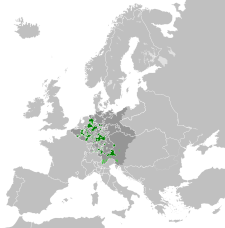
File:Ecclesiastical lands of the Holy Roman Empire 1789.svg

Dimensioni di questa anteprima PNG per questo file SVG: 450 × 456 pixel. Àutri risuluzzioni: 237 × 240 pixel | 474 × 480 pixel | 758 × 768 pixel | 1 011 × 1 024 pixel | 2 021 × 2 048 pixel.
Virsioni a àuta risuluzzioni (File SVG, diminzioni numinali 450 × 456 pixel, grannizza dû file: 928 KB)
Discrizzioni


.svg)
.svg)
.svg)
.svg)
.svg)


.svg)
.svg)
.svg)


.png)
.png)


.svg)


.svg)

.svg)


.svg)
.svg)
.svg)
.svg)


.svg)
.png)


.svg)


.svg)
.svg)


.svg)


.svg)


.svg)
.svg)
.svg)
.svg)
.svg)
.svg)
.svg)
_cropped.svg)
.svg)
.svg)
.svg)
.svg)
.svg)
.svg)
.svg)
.svg)
.svg)
.svg)
.svg)
.svg)
.svg)
.svg)
.svg)
.svg)
.svg)
.svg)
.svg)
.svg)
.svg)
.svg)
.svg)
.svg)
.svg)
.svg)
.svg)
.svg)
.svg)
.svg)
.svg)
.svg)
.svg)
.svg)
.svg)
.svg)
.svg)
.svg)
.svg)
.svg)
.svg)
.svg)
.svg)
.svg)
.svg)
Licenza
Io, detentore del copyright su quest'opera, dichiaro di pubblicarla con la seguente licenza:
Stu file è suttapostu â licenza Creative Commons Attribution-Share Alike 3.0 Unported.
- Sî lìbbiru:
- di cunnivìdiri – di cupiari, diffùnniri e trasmèttiri st'òpira
- di canciari – d'adattari l'òpira
- Sutta ê siguenti cunnizzioni:
- attribbuzzioni – Hai a dari attribbuzzioni di l’òpira â manera spicificata dû sò auturi o dû titulari dâ licenza (pirò no a na manera chi pò fari pinzari chi iḍḍi sustèninu o a tìa o lu tò utilizzu dâ sò òpira)
- sparti â stissa manera – Si canci, trasformi, o sfrutti st'òpira comu puntu di partenza, poi diffùnniri l'òpira chi nni risurta sulamenti sutta â stissa licenza di chista o puru una sìmili.
Registro originale del caricamento
This image is a derivative work of the following images:
- File:Europe_1789.svg licensed with Cc-by-sa-3.0
- 2013-04-14T03:44:26Z Alphathon 450x456 (858577 Bytes) Corrected some errors in northern Italy
- 2013-04-14T01:38:01Z Alphathon 450x456 (853881 Bytes) tweaked again
- 2013-04-14T01:36:10Z Alphathon 450x456 (853881 Bytes) Tweaked Holy Roman Empire border style
- 2013-04-14T01:33:26Z Alphathon 450x456 (853857 Bytes) == {{int:filedesc}} == {{Information |Description={{en|A blank Map of Europe circa 1789. This map also includes a border for the [[:en:Holy Roman Empire|Holy Roman Empire]]. Since there are so many small German states, they h
Uploaded with derivativeFX
Cronoluggìa dû file
Fari clic supra un gruppu data/ura pi vìdiri lu file comu si prisintava ntô mumentu nnicatu.
| Data/Ura | Miniatura | Diminsioni | Utenti | Oggettu | |
|---|---|---|---|---|---|
| currenti | 09:47, 17 utt 2021 | | 450 × 456 (928 KB) | Fenn-O-maniC | Fixed the Russo-Swedish border to match the Treaty of Åbo of 1743 |
| 22:55, 18 apr 2013 |  | 450 × 456 (952 KB) | Alphathon | == {{int:filedesc}} == {{Information |Description={{en|A map of the Ecclesiastical lands of the Holy Roman Empire, that is, lands ruled by a Prince-Bishop, within Europe circa 1789.}} |Source={{Derived fr... |
Pàggini c'ùsanu sta mmàggini
Nudda pàggina cunteni sta mmàggini.
Utilizzu glubbali dû file
Puru li wiki appressu ùsanu stu file:
- Utilizzu supra de.wikipedia.org
- Utilizzu supra ko.wikipedia.org