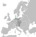
File:Duchy of Holstein 1789.svg

Virsioni a àuta risuluzzioni (File SVG, diminzioni numinali 450 × 456 pixel, grannizza dû file: 928 KB)
Stu file veni di Wikimedia Commons e purrìa èssiri adupiratu di àutri pruggetti. Appressu veni ammustrata la discrizioni prisenti ntâ sò pàggina di discrizzioni.
Discrizzioni
Licenza
- Sî lìbbiru:
- di cunnivìdiri – di cupiari, diffùnniri e trasmèttiri st'òpira
- di canciari – d'adattari l'òpira
- Sutta ê siguenti cunnizzioni:
- attribbuzzioni – Hai a dari attribbuzzioni di l’òpira â manera spicificata dû sò auturi o dû titulari dâ licenza (pirò no a na manera chi pò fari pinzari chi iḍḍi sustèninu o a tìa o lu tò utilizzu dâ sò òpira)
- sparti â stissa manera – Si canci, trasformi, o sfrutti st'òpira comu puntu di partenza, poi diffùnniri l'òpira chi nni risurta sulamenti sutta â stissa licenza di chista o puru una sìmili.
Registro originale del caricamento
This image is a derivative work of the following images:
- File:Europe_1789.svg licensed with Cc-by-sa-3.0
- 2013-04-14T03:44:26Z Alphathon 450x456 (858577 Bytes) Corrected some errors in northern Italy
- 2013-04-14T01:38:01Z Alphathon 450x456 (853881 Bytes) tweaked again
- 2013-04-14T01:36:10Z Alphathon 450x456 (853881 Bytes) Tweaked Holy Roman Empire border style
- 2013-04-14T01:33:26Z Alphathon 450x456 (853857 Bytes) == {{int:filedesc}} == {{Information |Description={{en|A blank Map of Europe circa 1789. This map also includes a border for the [[:en:Holy Roman Empire|Holy Roman Empire]]. Since there are so many small German states, they h
Uploaded with derivativeFX
Didascalie
Elementi ritratti in questo file
raffigura talianu
stato del copyright talianu
coperto da diritti d'autore talianu
14 apr 2013
dimensione dati talianu
950 411 byte
456 pixel
larghezza talianu
450 pixel
tipo di file talianu
image/svg+xml
checksum talianu
1e87a2180110e6b245b7aac6bc2841d711063758
Cronoluggìa dû file
Fari clic supra un gruppu data/ura pi vìdiri lu file comu si prisintava ntô mumentu nnicatu.
| Data/Ura | Miniatura | Diminsioni | Utenti | Oggettu | |
|---|---|---|---|---|---|
| currenti | 08:40, 17 utt 2021 |  | 450 × 456 (928 KB) | Fenn-O-maniC | Fixed the Russo-Swedish border to match the Treaty of Åbo of 1743 |
| 20:46, 18 apr 2013 |  | 450 × 456 (948 KB) | Alphathon | Various fixes and style change | |
| 14:51, 18 apr 2013 |  | 450 × 456 (846 KB) | Alphathon | Fixed Scandinavian borders | |
| 20:55, 14 apr 2013 |  | 450 × 456 (831 KB) | Alphathon | == {{int:filedesc}} == {{Information |Description={{en|A map of the Duchy of Holstein circa 1789.}}{{de|Eine Landkarte die Herzogtum Holstein c. 1789.}} |Source={{Derived from|Europe_1789.svg|display... |
Pàggini c'ùsanu sta mmàggini
Nudda pàggina cunteni sta mmàggini.
Utilizzu glubbali dû file
Puru li wiki appressu ùsanu stu file:
- Utilizzu supra ar.wikipedia.org
- Utilizzu supra az.wikipedia.org
- Utilizzu supra cs.wikipedia.org
- Utilizzu supra el.wikipedia.org
- Utilizzu supra en.wikipedia.org
- Utilizzu supra eo.wikipedia.org
- Utilizzu supra et.wikipedia.org
- Utilizzu supra fa.wikipedia.org
- Utilizzu supra fi.wikipedia.org
- Utilizzu supra fr.wikipedia.org
- Utilizzu supra he.wikipedia.org
- Utilizzu supra id.wikipedia.org
- Utilizzu supra mk.wikipedia.org
- Utilizzu supra ms.wikipedia.org
- Utilizzu supra pl.wikipedia.org
- Utilizzu supra ru.wikipedia.org
- Utilizzu supra tr.wikipedia.org
- Utilizzu supra uk.wikipedia.org
- Utilizzu supra www.wikidata.org
- Utilizzu supra zh.wikipedia.org
Metadati
Stu file cunteni nfurmazzioni agghiuntivi, prubbabbirmenti junti dâ fotucàmira o dû scanner usati pi criàrila o diggitalizzàrila. Siddu lu file hà statu canciatu, arcuni dittagghi putìssiru nun currispùnniri â rialitati.
| Tìtulu curtu | A map of Holstein within the Holy Roman Empire and Europe ca. 1789 |
|---|---|
| Discrizzioni dâ mmàggini | A map of the Duchy of Holstein within the Holy Roman Empire, and within Europe, circa 1789. This map is licensed under the Creative Commons Attribution-Share Alike 3.0 Unported license (https://creativecommons.org/licenses/by-sa/3.0/) by the wikimedia user "Alphathon" (http://commons.wikimedia.org/wiki/User:Alphathon), and is based upon "Blank map of Europe.svg" (http://commons.wikimedia.org/wiki/File:Blank_map_of_Europe.svg), the details of which follow:
A blank Map of Europe. Every country has an id which is its ISO-3166-1-ALPHA2 code in lower case. Members of the EU have a class="eu", countries in europe (which I found turkey to be but russia not) have a class="europe". Certain countries are further subdivided the United Kingdom has gb-gbn for Great Britain and gb-nir for Northern Ireland. Russia is divided into ru-kgd for the Kaliningrad Oblast and ru-main for the Main body of Russia. There is the additional grouping #xb for the "British Islands" (the UK with its Crown Dependencies - Jersey, Guernsey and the Isle of Man) Contributors. Original Image: (http://commons.wikimedia.org/wiki/Image:Europe_countries.svg) Júlio Reis (http://commons.wikimedia.org/wiki/User:Tintazul). Recolouring and tagging with country codes: Marian "maix" Sigler (http://commons.wikimedia.org/wiki/User:Maix) Improved geographical features: http://commons.wikimedia.org/wiki/User:W!B: Updated to reflect dissolution of Serbia & Montenegro: http://commons.wikimedia.org/wiki/User:Zirland Updated to include British Crown Dependencies as seperate entities and regroup them as "British Islands", with some simplifications to the XML and CSS: James Hardy (http://commons.wikimedia.org/wiki/User:MrWeeble) Validated (http://commons.wikimedia.org/wiki/User:CarolSpears) Changed the country code of Serbia to RS per http://en.wikipedia.org/wiki/Serbian_country_codes and the file http://www.iso.org/iso/iso3166_en_code_lists.txt (http://commons.wikimedia.org/wiki/User:TimothyBourke) Uploaded on behalf of User:Checkit, direct complaints to him plox: 'Moved countries out of the "outlines" group, removed "outlines" style class, remove separate style information for Russia' (http://commons.wikimedia.org/wiki/User:Collard) Updated various coastlines and boarders and added various islands not previously shown (details follow). Added Kosovo and Northern Cyprus as disputed territories. Moved major lakes to their own object and added more. List of updated boarders/coastlines: British Isles (+ added Isle of Wight, Skye, various smaller islands), the Netherlands, Germany, Czech Republic, Denmark, Sweden, Finland, Poland, Kaliningrad Oblast of the Russian Federation (and minor tweaks to Lithuania), Ukraine, Moldova (minor), Romania, Bulgaria, Turkey, Greece, F.Y.R. Macedonia, Serbia, Bosnia and Herzegovina, Montenegro, Albania, Croatia, Italy (mainland and Sicily), Malta (http://commons.wikimedia.org/wiki/User:Alphathon). Added Bornholm (http://commons.wikimedia.org/wiki/User:Heb) Released under CreativeCommons Attribution ShareAlike (http://creativecommons.org/licenses/by-sa/2.5/). |
| Larghizza | 450 |
| Autizza | 456 |


