
File:West Germany 1956-1990.svg

Dimensioni di questa anteprima PNG per questo file SVG: 450 × 456 pixel. Àutri risuluzzioni: 237 × 240 pixel | 474 × 480 pixel | 758 × 768 pixel | 1 011 × 1 024 pixel | 2 021 × 2 048 pixel.
Virsioni a àuta risuluzzioni (File SVG, diminzioni numinali 450 × 456 pixel, grannizza dû file: 471 KB)
Discrizzioni


.svg)
.svg)
.svg)
.svg)
.svg)


.svg)
.svg)
.svg)


.png)
.png)


.svg)


.svg)

.svg)


.svg)
.svg)
.svg)
.svg)


.svg)
.png)


.svg)


.svg)
.svg)


.svg)


.svg)


.svg)
.svg)
.svg)
.svg)
.svg)
.svg)
.svg)
_cropped.svg)
.svg)
.svg)
.svg)
.svg)
.svg)
.svg)
.svg)
.svg)
.svg)
.svg)
.svg)
.svg)
.svg)
.svg)
.svg)
.svg)
.svg)
.svg)
.svg)
.svg)
.svg)
.svg)
.svg)
.svg)
.svg)
.svg)
.svg)
.svg)
.svg)
.svg)
.svg)
.svg)
.svg)
.svg)
.svg)
.svg)
.svg)
.svg)
.svg)
.svg)
.svg)
.svg)
.svg)
.svg)
.svg)
| Chista è na mmàggini rituccata, lu chi signìfica ca fu canciata diggitalmenti dâ sò virsioni origginali. Canciamenti: {{{1}}}. La virsioni origginali pò èssiri vista ccà: Blank map of Europe 1956-1990.svg.
|
Licenza
Io, detentore del copyright su quest'opera, dichiaro di pubblicarla con la seguente licenza:
Stu file è suttapostu â licenza Creative Commons Attribution-Share Alike 3.0 Unported.
- Sî lìbbiru:
- di cunnivìdiri – di cupiari, diffùnniri e trasmèttiri st'òpira
- di canciari – d'adattari l'òpira
- Sutta ê siguenti cunnizzioni:
- attribbuzzioni – Hai a dari attribbuzzioni di l'òpira â manera spicificata dû sò auturi o dû titulari dâ licenza (pirò no a na manera chi pò fari pinzari chi iddi sustèninu o a tìa o lu tò utilizzu dâ sò òpira)
- sparti â stissa manera – Si canci, trasformi, o sfrutti st'òpira comu puntu di partenza, poi diffùnniri l'òpira chi nni risurta sulamenti sutta â stissa licenza di chista o puru una sìmili.
Registro originale del caricamento
This image is a derivative work of the following images:
- File:Blank_map_of_Europe_1956-1990.svg licensed with Cc-by-sa-3.0
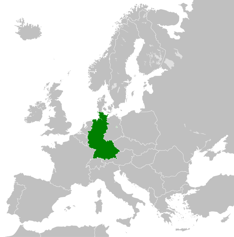
- 2011-10-30T04:43:42Z Alphathon 450x456 (485146 Bytes) == {{int:filedesc}} == {{Information |Description={{en|Blank map of Europe showing national borders as they stood from 1956-1990.}} |Source=*[[:File:Blank_map_of_Europe.svg|]] |Date=2011-10-30 04:42 (UTC) |Author=*[[:File:Bla
Cronoluggìa dû file
Fari clic supra un gruppu data/ura pi vìdiri lu file comu si prisintava ntô mumentu nnicatu.
| Data/Ura | Miniatura | Diminsioni | Utenti | Oggettu | |
|---|---|---|---|---|---|
| currenti | 03:31, 28 sit 2018 | | 450 × 456 (471 KB) | FelipeRev | Se incluye Berlín Oeste pero con un color diferente, para marcar que pertenecía a su espacio económico |
| 06:04, 15 giugn 2015 |  | 450 × 456 (476 KB) | Elevatorrailfan | Breaking apart West Germany and West Berlin paths. | |
| 03:43, 10 dic 2014 |  | 450 × 456 (476 KB) | Elevatorrailfan | West Berlin was not part of West Germany. | |
| 02:39, 26 nuv 2011 |  | 450 × 456 (474 KB) | StalwartUK | == {{int:filedesc}} == {{Information |Description={{en|Map of West Germany (Federal Republic of Germany) as it was from 1949-1990. Surrounding countries accurate from 1956-1990.}} |Source=*[[:File:Blank_map_of_Europe_1956-1990.svg|Bla |
Pàggini c'ùsanu sta mmàggini
Li pàggini siquenti richiàmanu sta mmàggini:
Utilizzu glubbali dû file
Puru li wiki appressu ùsanu stu file:
- Utilizzu supra af.wikipedia.org
- Utilizzu supra an.wikipedia.org
- Utilizzu supra ar.wikipedia.org
- Utilizzu supra ast.wikipedia.org
- Utilizzu supra be.wikipedia.org
- Utilizzu supra bn.wikipedia.org
- Utilizzu supra bs.wikipedia.org
- Utilizzu supra ca.wikipedia.org
- Utilizzu supra cs.wikipedia.org
- Utilizzu supra da.wikipedia.org
- Utilizzu supra el.wikipedia.org
- Utilizzu supra en.wikipedia.org
- Utilizzu supra eo.wikipedia.org
- Utilizzu supra es.wikipedia.org
- Utilizzu supra eu.wikipedia.org
- Utilizzu supra fi.wikipedia.org
- Utilizzu supra fr.wikipedia.org
- Utilizzu supra fr.wiktionary.org
- Utilizzu supra ga.wikipedia.org
- Utilizzu supra gl.wikipedia.org
- Utilizzu supra gv.wikipedia.org
- Utilizzu supra ha.wikipedia.org
- Utilizzu supra he.wikipedia.org
- Utilizzu supra hi.wikipedia.org
- Utilizzu supra hr.wikipedia.org
- Utilizzu supra ia.wikipedia.org
- Utilizzu supra id.wikipedia.org
- Utilizzu supra io.wikipedia.org
- Utilizzu supra it.wikipedia.org
- Utilizzu supra ja.wikipedia.org
- Utilizzu supra ka.wikipedia.org
- Utilizzu supra ko.wikipedia.org
- Utilizzu supra ku.wikipedia.org
- Utilizzu supra lij.wikipedia.org
- Utilizzu supra lld.wikipedia.org
- Utilizzu supra lmo.wikipedia.org
- Utilizzu supra lt.wikipedia.org
- Utilizzu supra lv.wikipedia.org
- Utilizzu supra mk.wikipedia.org
- Utilizzu supra ml.wikipedia.org
- Utilizzu supra mr.wikipedia.org
- Utilizzu supra ms.wikipedia.org
Talìa l'utilizzu glubbali di stu file.